 Threshold
Spend it on flight hours, not on software.
Charts, airspace, weather, NOTAMs and approach plates for student and general aviation pilots.
Why Threshold
Three things most weather apps get wrong.
Weather wherever you fly
METARs, TAFs and NOTAMs for 8,798 reporting stations in 238 countries, including military aerodromes overseas.
The whole country, offline
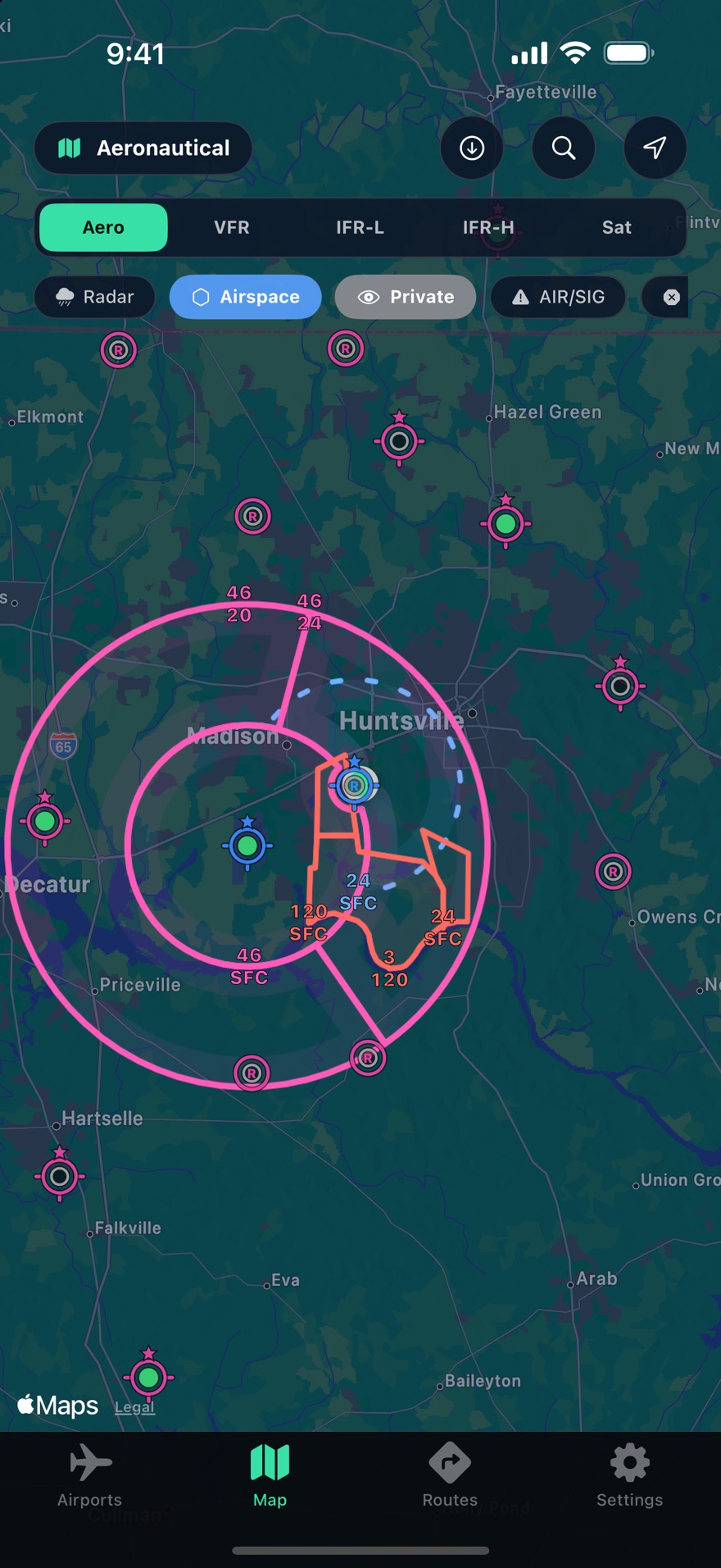
Every Class B, C, D and special-use boundary in the United States lives on your device. No spinner when you pan, no blank map without a signal, and it refreshes itself each 28-day cycle.
It says when data is missing
If a weather, TFR or NOTAM feed fails, Threshold tells you. A dead feed is never drawn as a clear sky, and stale weather is marked stale.
At a glance
Flight category, before you read a word.
Every airport on the map carries its current category, so the picture resolves before you tap anything.
Raw text and decoded tables
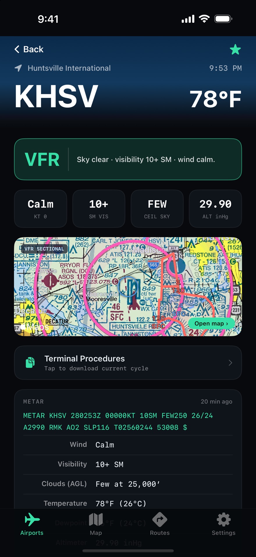
Raw METAR and TAF for the people who want it, decoded parameter tables for everyone else. Ceilings, visibility, wind components and present weather in plain English.
NOTAMs that don't lie to you
If the NOTAM system can't be reached, Threshold says so. It will never show an empty list and let you assume the field is clear, which is the one thing a briefing tool must never do.
Get started
Get in on the beta.
Early access, and an email the day Threshold launches. Nothing else.